When drone footage sells a house, and when it is just noise
Aerials are the easiest upsell in property media and the easiest one to waste. The difference is what is around the property.
Aerials are the easiest upsell in property media and the easiest one to waste. The difference is what is around the property.
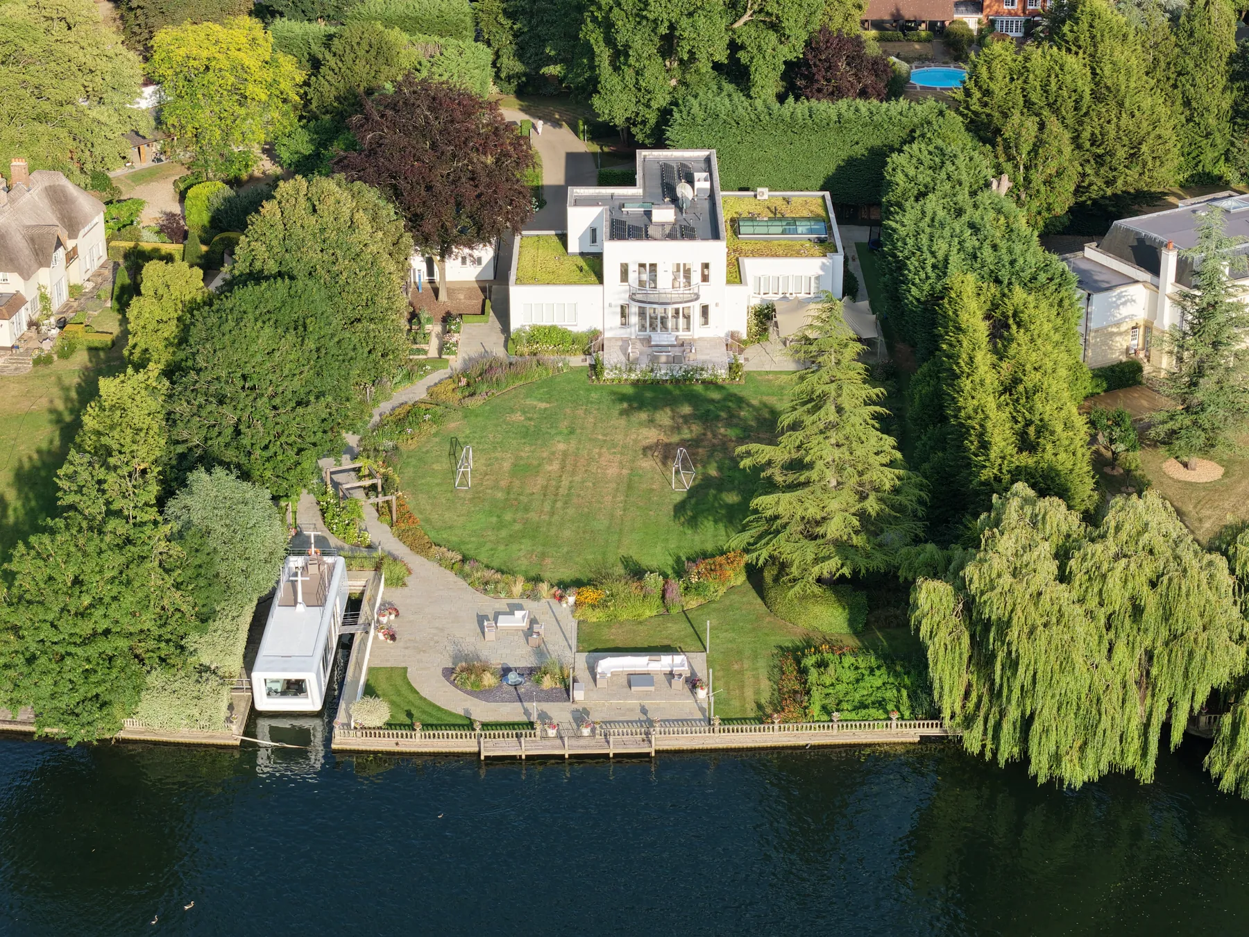
A drone answers exactly one question well, and it is a question about surroundings: what is this property in the middle of? Its plot, its street, its position relative to the water or the park or the ridge. When that context is a selling point, thirty seconds of aerial does more than any ground-level photograph can. When it is not, you have spent money showing a buyer a roof.
A mid-terrace in a dense street. A flat in a block, where the aerial shows a car park and eleven other flats. A property whose neighbours are its weakest feature. Here the drone is worse than neutral, because you have volunteered the information. Every listing has something it is not showing, and an aerial removes your ability to choose.
The test is simple. Before you book it, ask what the aerial will show that helps. If the honest answer is "the house from above", that is not a reason.
A drone shoot has a floor on it that a camera does not: airspace, weather and a licensed pilot. Restricted airspace near an airport or a prison is a hard no, not a delay. Wind above roughly twenty miles an hour makes footage unusable rather than difficult. And in the UK any commercial flight needs a CAA-licensed operator with insurance, which is a question worth asking whoever is flying, because the liability does not stay with them if it goes wrong.
Which is why the good version of this decision is made at booking, not on the day. A photographer who arrives and finds the airspace closed has wasted a slot; one who knew a week earlier has rebooked it.
Photography, floor plans and 360° tours, with the listing drafted for you to approve. Rolling monthly, no lock-in.